










































































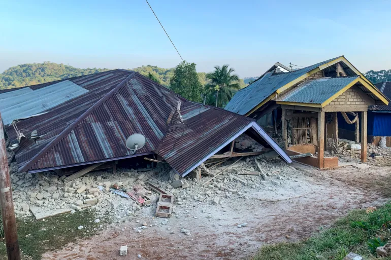
A devastating 7.7 magnitude earthquake struck off the coast of Flores Island in Indonesia, resulting in at least five confirmed fatalities and extensive structural destruction across the region. The seismic event, which triggered immediate concerns about the stability of the area, has left local authorities scrambling to assess the full scale of the disaster.
Data provided by the United States Geological Survey (USGS) indicates the quake occurred early Saturday morning at 5:58 am local time, which corresponds to 21:58 GMT on Friday. The epicenter was located approximately 68 kilometers north-northwest of Ende in East Nusa Tenggara province, with the tremor originating at a shallow depth of 10 kilometers.
The initial shock was followed by a series of significant aftershocks within the first thirty minutes. Seismologists recorded three subsequent tremors measuring magnitudes of 5.9, 5.6, and 6.1, further complicating the precarious situation for those trapped in the debris of collapsed structures.
According to Rudi Darmoko, the police chief for East Nusa Tenggara, early assessments confirm that two individuals perished in Sikka Regency, while three others died in Manggarai Regency. The fatalities were attributed to the collapse of buildings while the victims were sleeping, as confirmed by Governor Emanuel Melkiades Laka Lena during a press briefing.
Reporting from Jakarta, Al Jazeera correspondent Jessica Washington noted that local weather agencies anticipate aftershocks may persist for “several days.” As the situation remains fluid, the full extent of the destruction is still “emerging,” with reports indicating that “many houses have been damaged” across the northern regions of the island.
Authorities have issued urgent directives for residents to evacuate coastal zones and maintain a safe distance from damaged infrastructure. There is significant concern regarding the accessibility of remote areas, as some regions remain effectively isolated from emergency responders, hindering the delivery of critical aid to those in need.
Indonesia, a vast archipelago home to over 270 million people across 17,000 islands, is situated along the Pacific “Ring of Fire.” This geographic position makes the nation one of the most seismically active territories globally, frequently exposing its population to the dangers of sudden and violent tectonic activity.
The region is no stranger to such catastrophes; the same stretch of coastline was devastated by a similarly powerful earthquake in December 1992. That historic event, coupled with a subsequent tsunami, resulted in the tragic loss of more than 2,500 lives on Flores, serving as a grim reminder of the area’s vulnerability to major seismic events.
The United States Geological Survey (USGS) said the quake struck early on Saturday at 5:58am local time (21:58 GMT Friday), with an epicentre about 68 kilometres (42 miles) north-northwest of the city of Ende, in East Nu
USGS put the depth at 10km (6.2 miles).
Authorities have also advised locals to stay away from the shores and buildings, she said.
Source: Aljazeera