












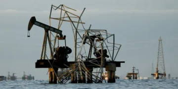

























































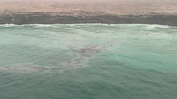
Omani authorities confirmed on August 12 that an oil spill originating from the sunken tanker ‘Caroline Bezengi’ has reached the country’s coastline. The Sultanate’s environmental authority reported that recent assessments identified oil contamination on several beaches within the Ras Madrakah area. Experts monitoring the situation anticipate the slick could extend further along the coastal stretch, potentially reaching a length of 40 kilometers in the immediate vicinity. There is also a projected risk that the pollution may spread toward the southern beaches of Masirah Island within the next few hours, covering a range of 10 to 20 kilometers.
The incident traces back to August 6, when the Ministry of Transport announced that the crude oil tanker had sunk near Al-Qibliyyah Island, part of the Al Hallaniyat archipelago in the Dhofar region. Initial observations indicated the spill moved northeast from the islands toward the mainland, covering an estimated extension of 449 kilometers. The ‘Caroline Bezengi,’ which sails under the Cameroon flag, measures approximately 274.48 meters in length and 48 meters in width.
In response to the environmental threat, the government has deployed technical teams from the ministry and various national agencies, supported by specialists from a private firm, to manage the crisis on the ground. Current operations include aerial surveillance, marine diving, and continuous field monitoring. Officials are utilizing satellite imagery and numerical modeling to track the slick’s movement and predict potential landing sites, with a specific focus on areas identified as having high environmental sensitivity.
Authorities have urged the public, including fishermen and beachgoers, to avoid approaching any observed pollutants and to report sightings immediately to the relevant agencies. The public has also been advised to rely exclusively on official sources for information and to disregard unverified figures, maps, or estimates circulating on social media.
Despite the spread, officials have reassured the public that there is currently no immediate threat to vital infrastructure, including water desalination plants, fish farming projects, and tourism facilities. Seawater quality is undergoing continuous testing to ensure these systems remain secure. The government maintains that emergency response plans were activated early to mitigate potential damage to public safety and the environment.
The primary operational goals are to contain the spill, identify the source of the leak, and maintain the integrity of the ship’s hull. A secondary, critical focus involves reducing the deterioration of the vessel to safely transfer its remaining oil cargo. Once the cargo is removed, plans are in place to salvage the hull while adhering to strict maritime safety standards.
The Al Hallaniyat Islands, located 40 kilometers off Oman’s southeastern coast in the Arabian Sea, are a remote group of five islands known for their ecological significance. Al Hallaniyah, the largest and only inhabited island in the group, is a popular destination recognized for its rich marine biodiversity. The islands are currently proposed for designation as a UNESCO nature reserve to protect critical habitats.
According to the UNESCO World Heritage Convention, these coastal waters support a diverse array of coral reefs, fish, and sea turtles that utilize the beaches for nesting. The area is also a vital habitat for dolphins, whales, and various seabirds, including the Masked Booby, the Socotra Cormorant, the Sooty Gull, and the Bridled Tern. The Socotra Cormorant is particularly notable, as these islands serve as its only breeding ground within Oman.
The environmental authority has pledged to provide regular updates as the situation evolves, emphasizing its commitment to transparency and public safety. Efforts to address the spill remain ongoing, with teams working to balance environmental protection with the complex technical requirements of salvaging a large-scale crude oil tanker.
The observations have led experts to believe that the slick could expand in the coastal stretch, reaching up to 40 km in length in the same area, also possibly spreading towards the southern beaches of Masirah Island in
Initially, it began by spreading northeast of the Hallaniyat Islands towards the mainland coast, moving along the same path, with its observed extension reaching about 449 km.
Stay up to date with the latest news.
Moreover, dolphins and whales can be seen daily.
Al Hallaniyyat is also considered a safe place for birds to lay eggs where their food is guaranteed.
Laraib Anwer is a Digital Journalist who loves the thrill of breaking headlines almost as much as she does unapologetically using GenZ slang.
She dreams of a world free of animal cruelty and hopes to tell community stories that make a difference.
Source: Khaleej Times