





















































As natural disasters continue to impact communities globally, the urgent need for precise, real-time data has become increasingly critical. Recent seismic events, including a 5.6-magnitude earthquake in Egypt and a 7.4-magnitude tremor in Colombia on August 10, 2026, have highlighted the vital role that space-based technologies play in modern humanitarian aid. By integrating satellite imagery, geospatial analytics, and artificial intelligence, international agencies are now better equipped to assess damage, monitor vulnerable regions, and coordinate efficient relief operations.
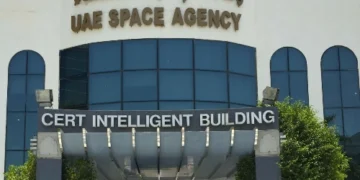
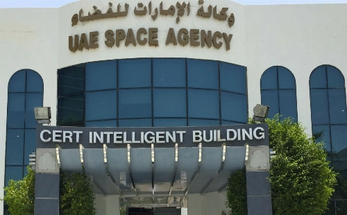
The United Arab Emirates has solidified its position as a key global partner in these efforts, particularly through its leadership of the International Charter: Space and Major Disasters. The UAE Space Agency held the presidency of this initiative from April to October 2026, overseeing a collaborative system that provides satellite data to nations facing crises. This leadership role, supported by the National Emergency Crisis and Disaster Management Authority (NCEMA), the Mohammed Bin Rashid Space Centre (MBRSC), and Space42, has significantly improved response times and the accuracy of emergency decision-making.
The International Charter serves as a premier global model for humanitarian cooperation, connecting 17 member organizations to share satellite imagery and data at no cost to authorized agencies. Since its inception, the Charter has facilitated over 1,168 activations, assisting 146 countries through a network of more than 270 satellites. This infrastructure has evolved from simple observation into a strategic tool for risk analysis and real-time disaster monitoring, directly contributing to the protection of lives and property.
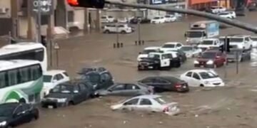
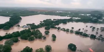
During the UAE’s tenure, the Charter responded to a diverse array of natural disasters, including floods, wildfires, volcanic eruptions, and earthquakes. In Kazakhstan, for instance, the initiative provided dual support during a difficult summer. In early July 2026, following heavy rainfall that caused flooding and riverbank erosion in the Almaty Region, the MBRSC provided satellite imagery to monitor the situation and guide local authorities. Earlier, on June 9, 2026, Space42 collaborated with the Charter to supply geospatial data during wildfires in the Akmola Region, allowing emergency teams to track the fire’s progression and optimize their response.
The impact of these space-based tools was also evident in Venezuela following two earthquakes that struck the north-central region on June 24, 2026. The UAE Space Agency and Space42 provided high-resolution imagery of the affected zones, while the Technology Innovation Institute (TII) and TACTICA conducted preliminary damage assessments. This multi-agency approach demonstrated how combining artificial intelligence with satellite data can streamline humanitarian interventions in the immediate aftermath of a disaster.
In Central Asia, the Charter was activated on May 25, 2026, to manage the aftermath of mudflows and flash floods in Kyrgyzstan. By working with the MBRSC, emergency responders received reliable geospatial data that facilitated effective crisis management. Similarly, in the Philippines, the Charter supported authorities following the eruption of the Mayon Volcano. Satellite imagery provided by the MBRSC allowed officials to monitor volcanic activity and evaluate the risks posed by ashfall to nearby communities, enhancing overall preparedness.
The UAE’s commitment to this mission extends to other regions as well, including recovery efforts in New Zealand following severe flooding. These activations underscore the growing importance of space science in humanitarian operations. By leveraging advanced technology, the UAE and its international partners are strengthening the global capacity to confront environmental crises, ensuring that decision-makers have the accurate information necessary to save lives and support affected populations during their most vulnerable moments.
Ultimately, the integration of space-based capabilities into disaster management represents a significant advancement in international cooperation. The success of the UAE’s presidency highlights how a unified national model—combining space expertise with emergency management—can bolster the effectiveness of global relief efforts. As these technologies continue to evolve, they will remain essential pillars in the world’s ability to monitor, mitigate, and recover from the increasing frequency of natural disasters. The report also notes that the Charter provides satellite imagery and data free of charge and in a timely manner to authorised agencies worldwide, supporting damage assessment, identification of affected areas, and the coordination of relief and humanitarian response operations, with 17 member organisations. The report also notes that earlier, on 9 June 2026, Kazakhstan benefited from another Charter activation after wildfires broke out in the Akmola Region. The report also notes that papua New Guinea: Responding to the impacts of Cyclone Mayla.
Source: Gulf Today